

. . . . . . . . . . . . . . . . . . .. . . . . . . . . . . . . . . . . .... .. . WEST
This included the District of Bunyoro in the north along the eastern shore of Lake Albert; Toro, located east of the Ruwenzori mountains ; the District of Ankole and in the extreme south west the mountainous district of Kigezi. The rail line connecting the area with the rest of Uganda and of East Africa ended at Kasese in Toro. Copper was shipped out of Toro, cattle largely out of Ankole, with smaller lots of cattle out of Toro. All four districts supplied labor for more economically active Uganda to the East. Agriculture with few export crops was largely subsistence with some production for local markets. There were several commercialization efforts. A project to facilitate tea growing in Toro; another a commercial fish processing plant at the north end of Lake George in Toro: and a scheme for commercial cattle production in Ankole. These were not major features of the agricultural landscape. There was tourist activity at the Murchison Falls National Park. The western area of Uganda as viewed from Kampala and Jinja was remote.
West Uganda was viewed largely by air. Bunyoro was lightly populated..
One flight crossed mid Bunyoro in the Butiaba area and a second entered
south of Karuma Falls in north Bunyoro near the village of Mutunda. Settled
areas of Toro and Ankole were traversed 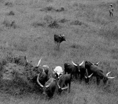 from the Semliki flats north
of Fort Portal in Toro, south through settled Toro to Kasese; a lunch
and fuel stop. The flight continued past the north end of Lake George
and into Ankole; then south passing to the east of Bushenyi; further
south for a further ten or so miles then turned east toward Mbarara another
fuel stop and the major town of Ankole.
from the Semliki flats north
of Fort Portal in Toro, south through settled Toro to Kasese; a lunch
and fuel stop. The flight continued past the north end of Lake George
and into Ankole; then south passing to the east of Bushenyi; further
south for a further ten or so miles then turned east toward Mbarara another
fuel stop and the major town of Ankole.
Flights by private aircraft were not allowed into Kigezi at that time. Both Kigezi and Ankole were visited by car. Air photo coverage was obtained for Kigezi from the Survey Department in Entebbe. These were detailed air photos taken for purposes of road realignment and or town planning. Several of these photographs are seen here. Main photo coverage for Kigezi was from the ground. The combination of views from air and ground demonstrate the surprisingly high percentage of land in cultivation in what at the time were the overcrowded landscapes of Kigezi.