

|
West Nile
West Nile was linked to the rest of of Uganda by two small car/ truck ferries across the Nile river; one at Pakwach in the south and the other at Laropi in the north.
 In 1963 the major culture groups living in West Nile had the following distribution: The Jonam were in the southeast corner to the west of Pakwach, the site of a Nile river ferry. The Alur occupied the southern part of West Nile to the west of the Jonam. The Lugbara lived throughout the western part, from War in the south through Arua and extending to and past Maracha in the north. The Kakwa occupied the northwest area of West Nile centered on Koboko. The Madi lived throughout the eastern portion extending from Okollo in the south to Moyo in the north. Place names noted are shown on the West Nile map from page 61 of the Atlas of Uganda, edition of 1962.
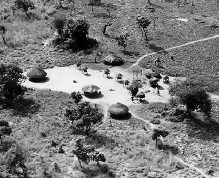
The West Nile air photographs were all taken on 11 June 1963, The flight started at Entebbe in Central Uganda, went to West Nile. On the return trip herding settlements in Buganda were photographed. It was a long and tiring flight day.