| |
JONAM..
. . . . .. . . .. . . . . . . . . . . . . . . . . . . .
. . . . . . . . . . . . . . . . . . . . . . . . . . . . .
.. . . . . . . . Jonam occupied the area of West NIle on the west bank of the NIle river. It extended twenty five or so miles to the north and to the south of Pakwach the ferry site.
Jonam and the rest of West Nile was visited by auto a month or so before the
flight. One or another scene comes from this source. The flight entered Jonam
from the south in the Panimur area north of the Albert Nile passing through the
population cluster to the south and west of Pakwach. (We observed only central
and southern Jonam.) The route then turned west staying south of the Pakwach
- Nebbi road. .. .. . . . . . .. . . . . . . .. . .. .
.. . . . . . . . . . . . .. . . . . .. . . . Several
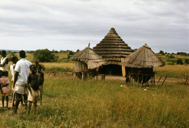
miles to the West of Pakwach. The vegetation pattern through out the area is
seen here as scattered trees and thicket with an understory of grasses. The tiered
house roof thatch is found through
out Jonam.
|
|
|
63c 24 #36
Lat 2º 27' N
Long 31º 27'E..
.. 1
|