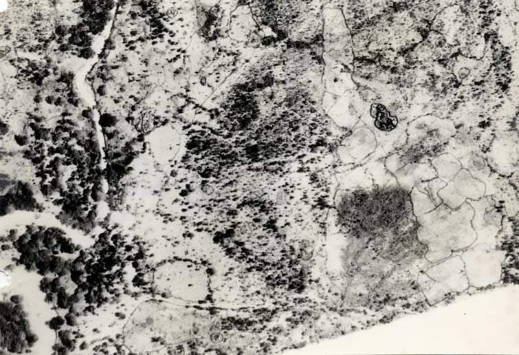
DODOS
High altitude air photo of a settled area in central Dodos. The Loyoro river (a dry river) is in the riverain forest on the left. A large settlement is on the right. The dark lines, the clear ones, are boundaries for cultivated fields. They are constructed of living sisal like, sharply pointed plants and serve as anti goat fence. The more diffuse lines are trees which have colonized the nutrient rich organic debris of former field boundary fences. These lines show that shifting cultivation has been used over nearly all of this landscape and for many decades.
|