BUGANDA North to South ..
. . . . . .. . . .. . . . . . . . . . . . . . . . . . . .
. . . . . . . . . . . . . . . . . . . . . . .The flight passed from Namasale on the north side of Lake Kyoga; entered Buganda to the east of Nakasanagola, continued south staying west of the Kampala urban area, continuing south landing at Entebbe. Precise location of images is not possible for this particular flight. Latitude and longitude will not be given. Photo identification numbers increase from north to south. Images are presented in that order.
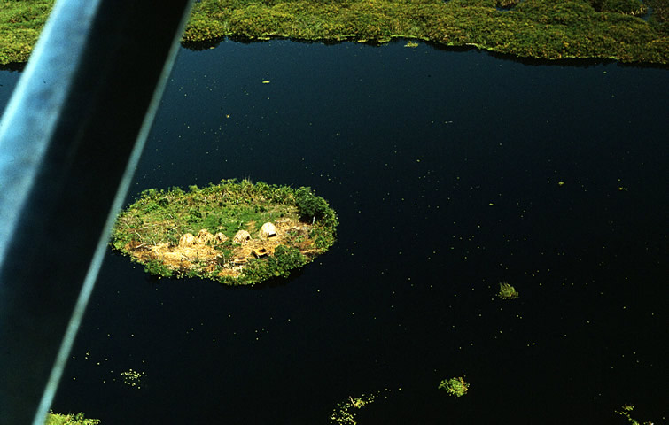
Settlements and agriculture were diverse. In north and western Buganda there were few people. We saw widely scattered cattle camps and several large coffee farms. About 30 miles south of Lake Kyoga rural population densities were high with a landscape of smaller farms cultivating plantain banana with an understory of coffee trees. Sweet potato/ yam plantings are visible in some of the images. There was a large fraction of total land in cultivation.
House forms characteristic elsewhere in Uganda were seen here in small numbers. This reflects migrant workers moving to a prosperous farming area.
|