

|
ANKOLE
. . . . . . . . . . . . . . . . . . . . . . . . . . . . . . . ..
. . . . . . . . . . . . . . . . . . . . . . . . . . . . . . . .
. . .. . Located to the south of Toro, Ankole had agricultural
settlements concentrated to the south and west of the Kasese to
Mbarara road. Cattle and small stock herding were found throughout
Ankole. The first settlements shown were in the area from south
of Lake George to Bushenyi and on to the southeast of Bushenyi.
The inhabitants were primarily cultivators of bananas and root crops.
Further east toward Mbarara, groups of Ankole cattle but few corrals
were seen. To the south east of Mbarara further cultivation was
seen. Photo coverage of the area north of Bushenyi was compromised
by low light levels associated with a severe, passing storm. Settlements
in the Bushenyi area of north and west Ankoli were small with associated
banana patches, root crops and horizontal ridges on the land caused
by heavy goat feeding. Agricultural settlements located to the east
and south of Mbarara were larger and were found within more extensive
banana groves. . . . . . . . . . . . . . .
. . . . . . . . . . . . . . . ...... . . . . . . . . . . . . . .
. . .... . . . . . . . . . . . . . . . ...... . . . . . . . . .
. . . . . . . . . . . . . . . . . . . . . . . . . . . . . . . .
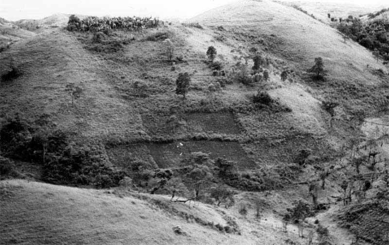
. . . . . . . . . . . . . . . . . . . . . This photo shows
cultivation patches in hill country of north Ankole. See the ridges
left by goat browsing at left and the banana grove at the hill top.
|
63 69 #5... .. . ........ 13 Nov 1963 ... .. .. Lat 0º 20' S Lat. .. . . .Long 30º 10' E ..... .. . 1
© 2010 Uganda1963.org